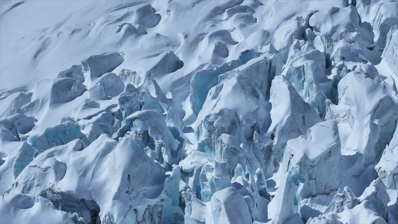
After a blustery day of wind and snow, the skies over Renlongba Glacier in Xizang cleared, setting the stage for a groundbreaking airborne mission! 🚁❄️
Launched earlier this week, China’s first space-to-sea glacier survey is on a mission to decode the mysteries of marine glaciers – natural ice bodies that have graced polar and high mountain regions for years and slowly drift along the terrain. The low-altitude helicopter, outfitted with innovative rectangular ice-penetrating radars and a homegrown airborne gravimeter, took off from Renlongba in Qamdo City. Chief scientist Xiong Shengqing noted, "Our gravimeter has achieved world-class precision, while being only one-third the size of comparable foreign instruments."
Over the next two weeks, the helicopter will glide over key glacier zones across southeastern Xizang, covering roughly 1,000 square kilometers. In tandem, two Gaofen satellites are capturing high-resolution images to build a detailed 3D model of the glacier. This pioneering blend of space, air, and ground technologies is not only a sci-fi adventure come to life but also an essential effort to better understand climate change and support natural resource management.
Stay tuned as scientists are expected to unveil the full results of this mission within the next three to four months, marking a significant milestone in marine glacier research.
Reference(s):
China's first space-to-sea glacier survey underway in Xizang
cgtn.com